ATTENTION! TOUTES LES FONCTIONS NE SONT PAS DISPONIBLES DANS LES EMAILS. UTILISEZ PLUTÔT LA VERSION NAVIGATEUR: http://nbbc-met.blogspot.fr/. WARNING, ALL FUNCTIONS NOT AVAILABLE IN EMAIL... INSTEAD, USE THE BROWSER VERSION: http://nbbc-met.blogspot.fr/
National Hurricane Center via Wunderground
 | AMÉLIORATION TEMPORAIRE |
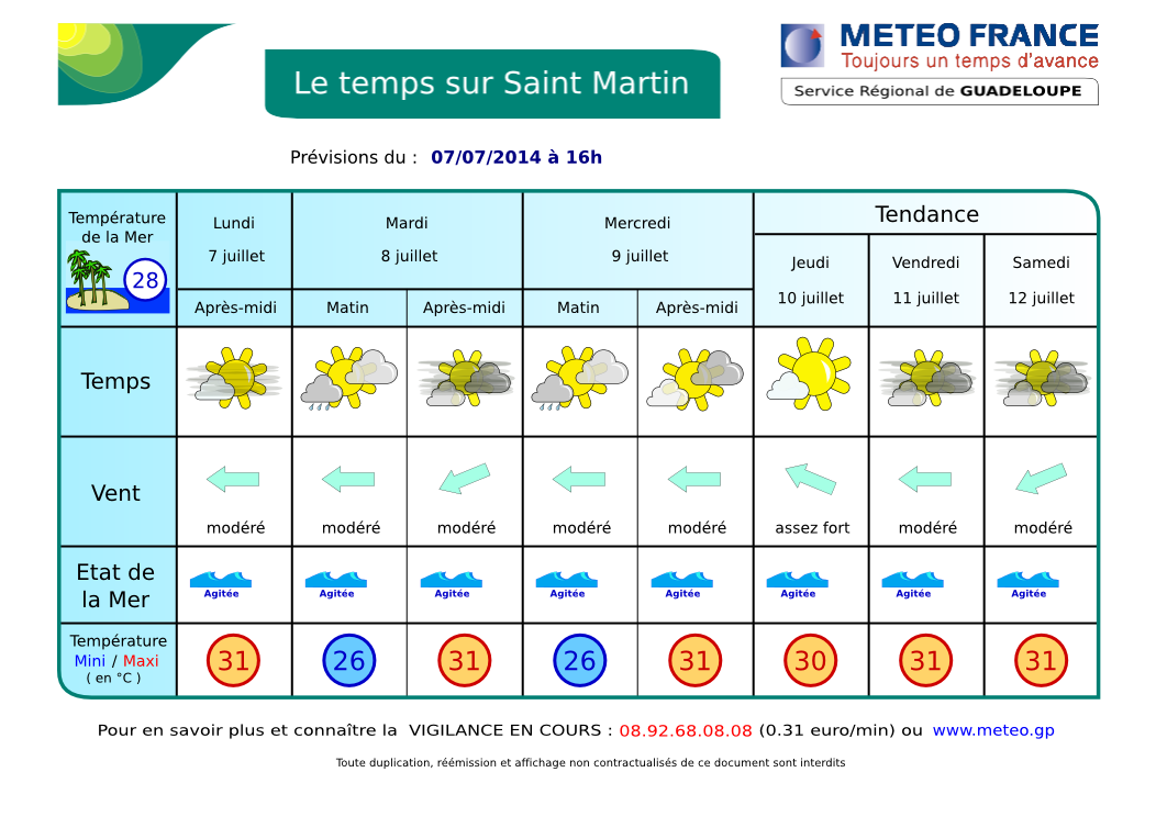
Légère amélioration, mais le temps reste humide et il y a encore un potentiel d'averses surtout pour la nuit prochaine et demain mardi. Aujourd'hui, on peut s'attendre à de belles périodes ensoleillées et un temps brumeux avec de faibles chances d'averses. Demain, averses possibles.
Les vents généralement d'est resteront modérés à relativement frais (c-à-d assez forts). La mer restera peu agitée à l'abri des îles à très agitée au large.
Une autre Onde Tropicale devrait arriver sur les Petites Antilles mercredi ou jeudi. Elle n'est pas très active du moins pour l'instant mais pourrait apporter quelques averses.
Une troisième Onde très oblique et orientée ouest-sud-ouest à est-nord-est devrait arriver pendant le weekend. Elle semble être accompagnée de beaucoup de nuages et de quelques orages. A surveiller donc.
RIEN NE MENACE NOS ÎLES.
Plus de détails plus bas.
 | TEMPORARY IMPROVEMENT |
The Tropical Wave which moved across the Lesser Antilles yesterday has partly dissipated bringing relatively rare showers. It is moving away over Caribbean Sea.
Today expect large sunny spells and some rares light to moderate showers. Slight improvement, but there is still a potential of showers especially tonight and tomorrow maybe. Today, we can still expect large sunny periods but hazy with a slight chance of showers. Generally, easterly winds will remain moderate to fresh. Seas will remain slight away from islands and choppy over open waters.
Another Tropical wave is expected to cross the Lesser Antilles from Wednesday or Thursday. It is not very active at least for now.
A third very obliquely oriented west-southwest to east-northeast Wave is expected to arrive over the weekend. It seems to be accompanied by lots of clouds and few thunderstorms. Therefore, keep an eye on...
NO THREAT TO OUR ISLANDS
More information bellow (after the webcams)
| Webcams St Martin-St Barts | ||
 |
|
 |
| Nettle Bay Beach Club, netcam3, anse 3 | Nettle Bay Beach Club. Netcam1, anse 3 | Nettle Bay Beach Club, netcam2 (anse 4) |
 |
 |
|
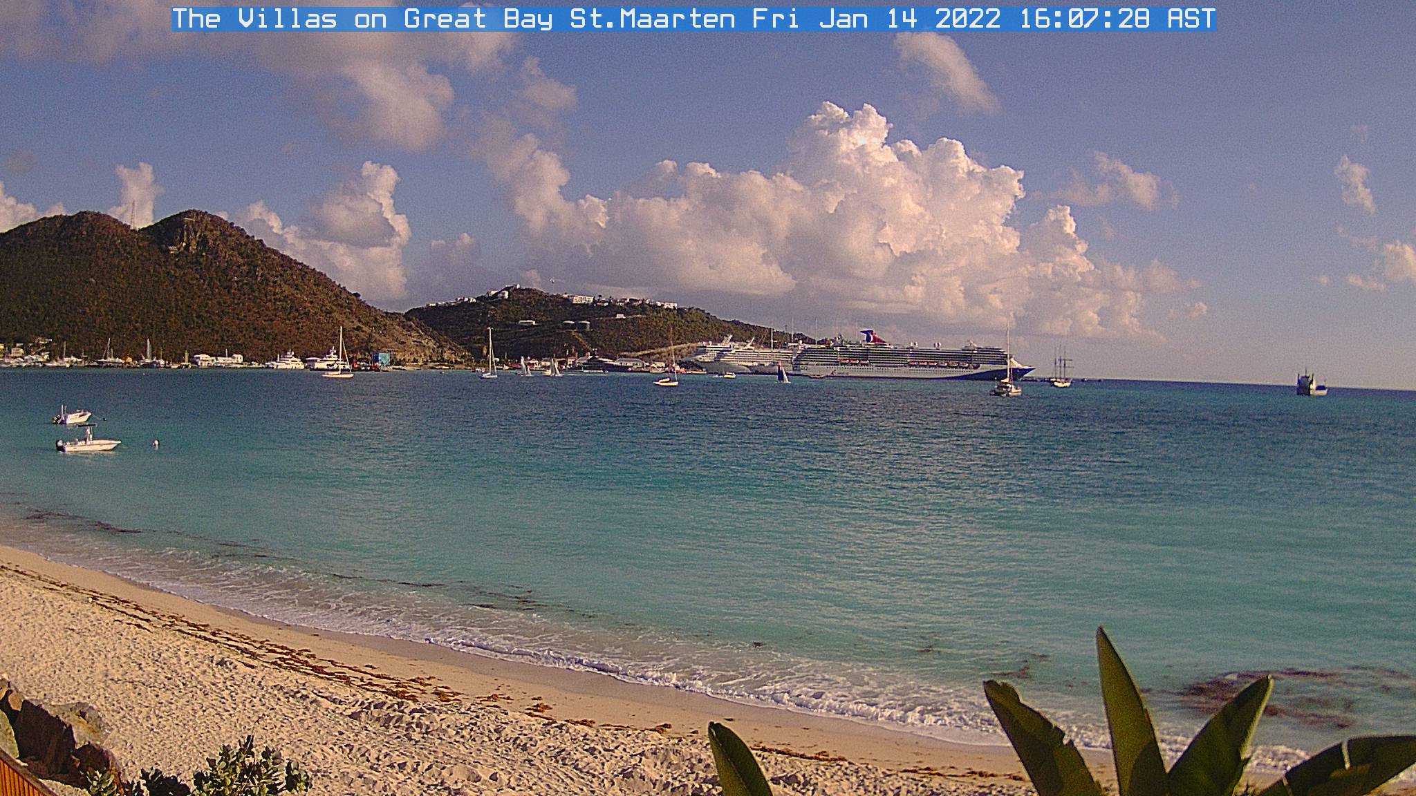
| Philpsburg, Great Bay | St Barts, Gustavia | Baie St Jean, St Baths |
| LA METEO DE BAIE NETTLÉ |
- VIGILANCE OU ALERTE: aucune.
- VENTS: Pas de changements. Alizés d'est modérés à assez forts avec de fortes rafales possibles en avant des grains. MER: peu agité à agitée en Baie de Marigot. Très agitée au large. Température mer 28º C environ. HOULE: d'Est non gênante en Baie de Marigot. VISIBILITÉ: faible sous averse. Pas mal de brume de sable faiblissant demain.
- DONNÉES: vent d'est 20 à 40 kmh, possible plus fort dans les rafales. Mer 1.2 à 2 m en Atlantique. Petite houle d'Est environ 1.5 m, 7-8 secondes (pas de changement). Plus de détails.
- CYCLONES: Rien en vue. RIEN NE MENACE NOS ÎLES.
- FRANCE demain: Le soleil va progressivement perdre du terrain. Avant l'arrivée d'une perturbation atlantique, il va encore faire chaud sur la majeure partie des régions sous un ciel encore assez lumineux. Mais sur une bonne moitié nord-ouest du pays le temps sera parfois lourd avec des nuages plus nombr... suite: Bulletin Météo France. QUEBEC: nuageux avec averses: MeteoMedia Détails
- NAVIRES: Rien de particulier.
| BAIE NETTLÉ FORECAST |
- WATCH OR WARNING: None.
- SEAS: Slight to possibly choppy in the Bay, choppy to rough over open waters. Water temperature 82.4º F. SWELL: From east Insignificant here. Moderate to choppy on Atlantic waters. VISIBILITY: poor in showers. Moderate sand dust haze decreasing tomorrow.
- DATA: Winds: easterly, 12-25 Mph. Seas: 4-5-6-7 ft. Swells: easterly 5 ft, 7-8 seconds. More data....
- TROPICAL CYCLONE: No tropical cyclone at this time.
- USA: ...hot weather in the West and muggy conditions with chances of showers and thunderstorms in the East... Weather. CANADA: cloudy with chance of showers. Weather (English).
- SHIPS: Nothing to report.
AIDE- INFO - HELP

Image Satellite Infra-rouge Petites Antilles. Ne s'affiche pas dans certains emails. Ce n'est plus une animation mais une image fixe de manière à alléger la page. Cliquez ici pour voir l'animation dans un pop-up.
Lesser Antilles infrared loop. Does not appear in some emails. It is no longer a loop but a still image to lighten the page.. Click here to see the loop in pop-up.
Image Satellite Infra-rouge Petites Antilles. animation en pop-up - Lesser Antilles infrared image. loop in pop-up.
| . |
ORAGES - THUNDERSTORMS
Zoom - St Martin: point rouge - red dot (rafraîchissement toutes le 5 mn - refreshes every 5 mn)
Prévisions graphiques - Meteo France - Graphic forecast