ATTENTION! TOUTES LES FONCTIONS NE SONT PAS DISPONIBLES DANS LES EMAILS. UTILISEZ PLUTÔT LA VERSION NAVIGATEUR: http://nbbc-met.blogspot.fr/. WARNING, ALL FUNCTIONS NOT AVAILABLE IN EMAIL... INSTEAD, USE THE BROWSER VERSION: http://nbbc-met.blogspot.fr/
National Hurricane Center (NHC). Vérifiez bien les dates! Check dates!
Nombre de messages limité à 1. Voir ici les autres "Tweets".
National Hurricane Center via Wunderground
 | RÉSUMÉ |
Détails... plus bas, après les webcams.
 | SUMMARY |
Prévisions météo graphiques du NHC (cliquez sur l'image pour l'agrandir)

NHC Graphicast, graphic forecast (Click image to enlarge)
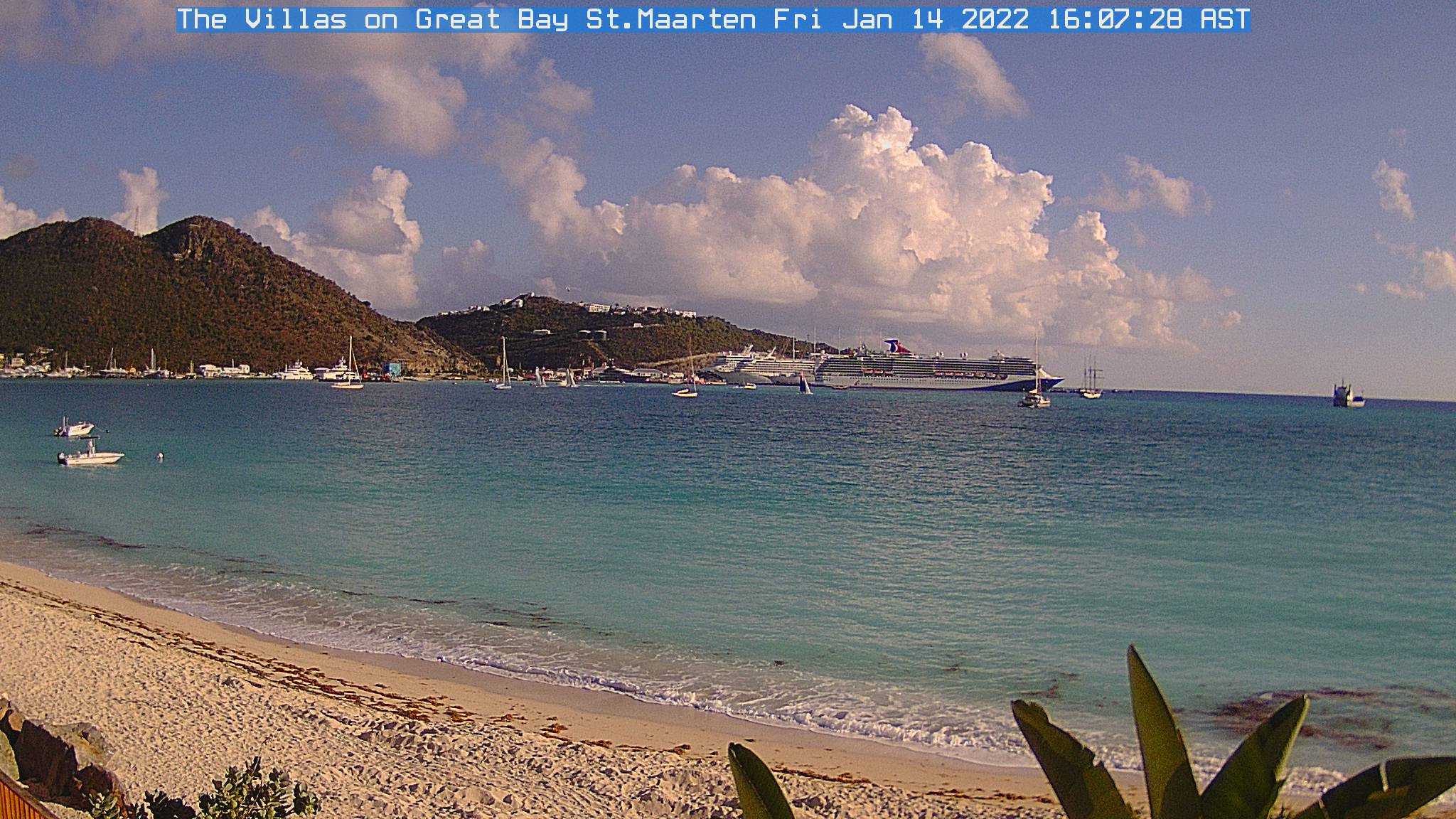
| Webcams St Martin-St Barts | ||
 |
|
 |
| Nettle Bay Beach Club, netcam3, anse 3 | Nettle Bay Beach Club. Netcam1, anse 3 | Nettle Bay Beach Club, netcam2 (anse 4) |
 |
 |
|
| Philpsburg, Great Bay | St Barts, Gustavia | Baie St Jean, St Baths |
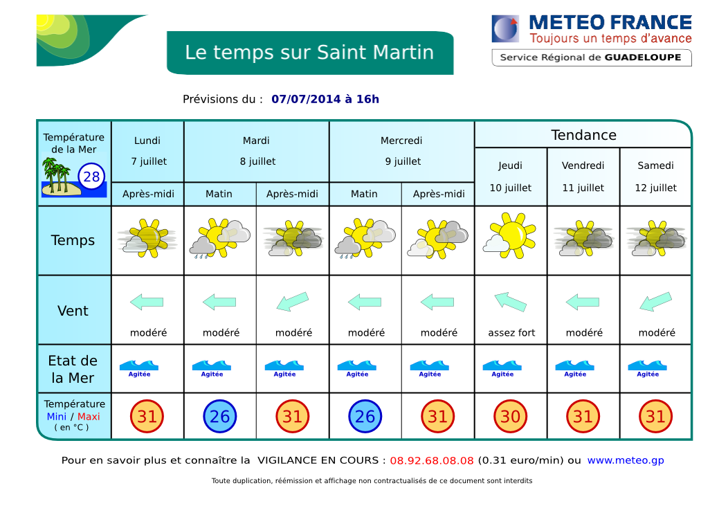
| LA METEO DE BAIE NETTLÉ |
- VIGILANCE OU ALERTE: aucune. Prudence pour les petits bateaux et baigneurs sur les façades Est des îles.
- DERNIÈRES 24 H: quelques courtes averses parfois brutales. ACTUELLEMENT: partiellement ensoleillé à parfois plus nuageux avec un risque d'averses isolées. AUJOURD'HUI / NUIT PROCHAINE: partiellement ensoleillé devenant très nuageux dans l'après-midi et la nuit prochaine. Chances de pluies. Voir SATELLITES.
- TENDANCE: jours suivants, relative amélioration possible à partir de demain jusqu'à samedi.... Nouvelle dégradation en vue due à une nouvelle Onde Tropicale à partir de samedi ou dimanche
- VENTS: Pas de changements. Alizés d'est modérés à assez forts avec de fortes rafales possibles en avant des grains. MER: peu agité à agitée en Baie de Marigot. Très agitée à parfois forte au large. Température mer 28º C environ. HOULE: d'est plus importante mais pas très gênante en Baie. VISIBILITÉ: faible sous averse. Pas mal de brume de sable.
- DONNÉES: vent d'est 20 à 40 kmh, possible plus fort dans les rafales. Mer 1.8 à 2.4 m en Atlantique, 1.2 à 1.5 côté Caraïbes. Houle d'Est environ 2,2 m, 8 secondes. Plus de détails.
- CYCLONES: Rien en vue. Un système sur le Yucatan (Mexique) à de faibles chances de se développer. Voir NHC. RIEN NE MENACE NOS ÎLES.
- FRANCE: Encore maussade sur la partie nord. Beau temps chaud à partir de vendredi et toute la semaine prochaine sur tout l'hexagone. Bulletin Météo France. QUEBEC: JEUDI : Ennuagement tôt le matin. 40 pour cent de probabilité d'averses en après-midi et en soirée. Vents devenant du sud-ouest à 30 km/h le matin. Maximum 27. VENDREDI : Alternance de soleil et de nuages. Minimum 19. Maximum 29. SAMEDI : Ensoleillé. Minimum 19. Maximum 28. DIMANCHE : Alternance de soleil et de nuages. Minimum 19. Maximum 26.
MeteoMedia Détails - NAVIRES: Oasis of the seas et Carnival Dream à Philipsburg
Oasis of the seas & Carnival Dream


| BAIE NETTLÉ FORECAST |
- WATCH OR WARNING: NONE. Beware of relatively rough seas along eastern shores of the islands. NO THREAT TO OUR ISLANDS.
- WEATHER... LAST 24 HR: partly sunny to cloudy skies with a few brief but sometimes violent showers. CURRENTLY: moderate easterly gusty winds. Partly cloudy to cloudy with some chance of a couple of isolated shower. TODAY / TONIGHT: This morning, partly sunny to cloudy becoming cloudier in the afternoon or tonight with a chance of showers. TOMORROW: chance of showers. Slight improvement expected later until Saturday morning. TREND: next days: new worsening during the weekend. SATELLITES.
- WINDS: moderate to fresh easterly tradewinds with higher gusts possible in showers. SEAS: Slight to possibly choppy in the Bay, choppy to possibly rough over open waters. Water temperature 82.4º F. SWELL: From east Insignificant here in the bay. Moderate to locally rough on Atlantic waters. VISIBILITY: poor in showers. Some sand dust haze.
- DATA: Winds: easterly, 12-25 Mph. Seas: 6-7-8 ft over Atlantic waters, 4-5 ft near Caribbean shores. Swells: easterly 6-7-8 ft, 8 seconds. More data....
- TROPICAL CYCLONE: No tropical cyclone at this time. However, a disturbance over Yucatan (Mexico) has 10% of becoming a tropical cyclone during the next 48 h. NHC
- USA: In the East, hot and humid weather conditions linger for the eastern third of the nation as the region remains in between a retrograding upper trough of low pressure over the Mid-U.S. and a blocking ridge of high pressure in the western Atlantic Ocean. Ample warm, moist flow streaming in from the south-southwest into the Eastern Seaboard will lead to muggy conditions with continued chances of showers and storms through the day. Expect chances of showers and thunderstorms to also persist for the Great Lakes and Ohio Valley. Weather. CANADA: Unsettled weather: Weather (English)
- SHIPS: See bellow french forecast
AIDE- INFO - HELP

Image Satellite Infra-rouge Petites Antilles. Ne s'affiche pas dans certains emails. Ce n'est plus une animation mais une image fixe de manière à alléger la page.
Lesser Antilles infrared loop. Does not appear in some emails. It is no longer a loop but a still image to lighten the page..
Image Satellite Infra-rouge Petites Antilles. animation en pop-up - Lesser Antilles infrared image. loop in pop-up.
| . |
ORAGES - THUNDERSTORMS
Zoom - St Martin: point rouge - red dot (rafraîchissement toutes le 5 mn - refreshes every 5 mn)
Prévisions graphiques - Meteo France - Graphic forecast